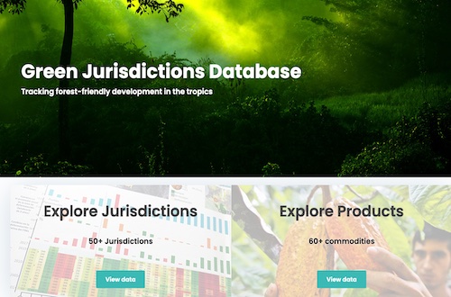
New ‘Green Jurisdictions Database’ tracks progress towards forest-friendly development in the tropics
Reliable, timely information is an essential pillar of sustainable development. This week the Earth Innovation Institute is launching an important new database designed to support states and provinces in tropical forest regions that are moving down this path.
“The Green Jurisdictions Database (GJD) is already being used in some of the world’s most progressive experiments in forest-friendly development,” says EII Executive Director Daniel Nepstad, “including Mato Grosso’s Produce, Conserve, Include strategy and the State of Acre’s green investment platform in Brazil, and the recently launched Caqueta Sustentable platform in Colombia.”
The GJD aggregates the best data available on forests, carbon emissions, agricultural production, social indicators, and the programs and policies that are in place to drive the transition to low-emission, forest-friendly development.
It makes available high quality new data from international sensors. “There’s been an important development in terms of data availability and information systems in the tropics,” notes EII Scientist and head of Geographical Information Systems (GIS) and Spatial Analysis Juan Ardila. “Tropical forest governments came to this late, but they’ve since made impressive gains thanks to support from the international community and [climate finance mechanisms] like REDD+ , which put a lot of money into country- and state-level monitoring systems.”

These systems made it possible for jurisdictions to establish goals for the reduction of emissions from deforestation, for example, yet they have gone largely unnoticed by the broader community of researchers, advocates and others invested in forest protection. “Those systems now have to be used,” says Ardila.
The GJD provides a detailed look at deforestation and related emissions through a jurisdictional lens, with added features that allow visitors to analyze a range of indicators including agricultural production, livestock, social and economic development and governance at the subnational level.
Users will also find area, productivity and production data for more than 60 crops, covering not only commodities like soy or palm oil—often linked to increased forest loss—but also regional crops like coffee, cacao, avocados, and durian.
The launch comes on the heels of the Leaders Summit on Climate, hosted by US President Joe Biden, where the new LEAF (Lowering Emissions by Accelerating Forest finance) initiative was announced, aiming to generate some $1 billion in funds to slow tropical deforestation. Funds for LEAF, which brings together government and private sector actors—including online retail giant Amazon, as well as the governments of Norway, the United Kingdom and the US—would come through the sale of national and jurisdictional carbon credits.
“To translate this long-awaited private sector commitment (to buy jurisdictional REDD credits) into progress on the ground, we need strategies that are owned and driven by tropical forests states and provinces and that are supported by reliable, accessible, timely data,” notes Nepstad.
The launch of the database also comes as world leaders prepare to meet during the upcoming COP26 climate summit in Glasgow, Scotland, where the issue of tropical deforestation is expected to take center stage.
The increased attention to tropical forests has led to heightened recognition of the important role that sub-national jurisdictions play in their protection. Supporting these jurisdictions in that effort requires an understanding of the dynamics behind regional forest loss, something existing platforms don’t currently offer, notes Ardila.

“Global monitoring systems are important for understanding deforestation across entire nations or continents, but the accuracy of the regional data is then compromised,” he says, giving as an example the case of palm oil. “When you look at the global data on deforestation from palm oil, you’re given data based on satellite imagery. Our database combines this imagery with on-the-ground data compiled by local ministries and state agencies. It’s the most reliable data you can find today, and it’s available across a range of indicators.”
That level of granularity is critical to a better understanding of deforestation and related challenges within individual jurisdictions and can better help to inform decision makers working to devise solutions.
In an interview with EII, Mato Grosso Secretary for Environment Mauren Lazzaretti described the PCI platform as a “pillar” of the state’s environmental and development policy and a key factor in recent successes in reducing forest loss.
According to Ardila, the PCI and other regional platforms are helping to increase transparency, providing a means of checking government claims on forest protection and sustainable development against all available data.
“These are data that have long been available in developed countries, but in tropical countries they have been hard to find, and even when available hard to access,” Ardila says. “With this database we’ve lowered the barrier to access, and we’ve done it across 55 JDXs (including roughly 1500 second order jurisdictions), with plans to cover nearly one half of all tropical forest jurisdictions worldwide by 2022.”
